
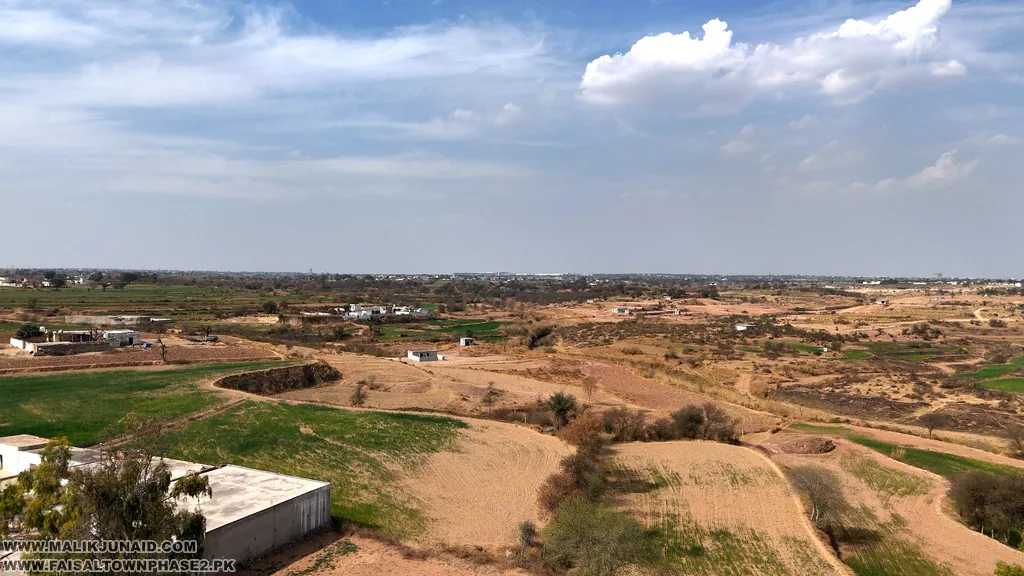
If you are searching for the Faisal Town Phase 2 full map, you are already starting in the right place. Before you compare plot prices, ask about booking, or follow the latest site visit videos, the smartest first step is to understand the full map. The map page on faisaltownphase2.pk presents a high-resolution master plan, offers a downloadable PDF and JPG, and says the layout helps buyers review block distribution, plot sizes, road networks, and key development areas before making any decision.
For buyers in Islamabad, Rawalpindi, and overseas Pakistanis, the Faisal Town Phase 2 full map is not just a file to download. It is a planning tool. The homepage positions the project around plots, maps, videos, and updates, while the map page breaks the society into sector-based resources so users can move from the big-picture master plan to more focused block-level analysis.
A full-map guide matters because a serious buyer wants answers to practical questions: Where is the project located? Which sectors are being highlighted? Which areas may suit investment better? How do the roads connect? And how should you match the map with payment plans and development updates? The project pages themselves are structured around exactly that buyer journey: map first, then payment plans, plots for sale, development updates, news, and consultation.
Why the Faisal Town Phase 2 Full Map Matters
A full map gives you the big picture that individual plot ads cannot. Instead of relying on forwarded images or dealer screenshots, a buyer can use the full master plan to understand how sectors fit together, how the road network is imagined, and where the project’s major districts sit in relation to one another. The map page explicitly says understanding the layout plan is key because it shows block distribution, plot sizes, road networks, and key development areas.
This matters even more in a large project like Faisal Town Phase 2 because the map page and homepage show a broad sector structure that includes Overseas Enclave, Education City, Model Block, Sports City, and a wide alphabetical sector spread running through many sector pages. That tells buyers the project is being marketed through multiple micro-locations, not just one uniform block.
So when someone asks for the Faisal Town Phase 2 full map, they are usually asking for more than a map image. They are really asking for location understanding, sector comparison, development context, and buying confidence. That is exactly how you should use it.
How to Download the Faisal Town Phase 2 Full Map
The cleanest starting points are the project’s own map resources and the related MalikJunaid pages:
- Faisal Town Phase 2 main website
- Faisal Town Phase 2 Maps
- Faisal Town Phase 2 Map PDF page
- Faisal Town Phase 2 master plan download on MalikJunaid.com
- Faisal Town Phase 2 map download/view
The dedicated map page says users can click to open or download the PDF map and also provides a JPG version. The MalikJunaid master-plan page also points readers to the downloadable PDF hosted on faisaltownphase2.pk and positions it as the “big-picture orientation” for the society.
That means the best workflow is simple: download the full master plan first, zoom in to understand the overall layout, and then move to the sector-specific maps if you want more detail.
What the Faisal Town Phase 2 Full Map Shows
A useful full map should help a buyer see the society in layers.
1) The overall master plan
The map page is built around a “Download High Resolution Faisal Town Phase 2 Map” section and clearly treats the master plan as the core resource for understanding the project before choosing any plot.
2) Sector-by-sector breakdown
The same page offers separate sector-map downloads for groups such as Sector ABFGHY + CBD, Sector C & D-1, Sector E – Lake District, Sector I, Sector J – Education City & Sports City, Sector L & K, Sector M, N, O & P, Sector Q, R, S & T, and Overseas Sector W & X. That matters because the full map gives the overview, while the grouped sector maps help narrow down specific pockets later.
3) District identity
The navigation structure highlights named project zones such as Overseas Enclave, Education City, Model Block, and Sports City, which gives buyers a clue that some parts of the project are being positioned with distinct identities or themes.
4) Road and development logic
The development page ties map-reading to on-ground features like road infrastructure, plot demarcation, and sector-wise development status, especially around Sector O, Model Block, Main Boulevard, and nearby Thalian Interchange areas. That gives the full map more value because you are not just looking at planning on paper; you are comparing the plan with visible progress.
Faisal Town Phase 2 Location: Why the Full Map Is So Important
The map becomes much more powerful when you understand the project’s broader location story. The MalikJunaid overview page describes Faisal Town Phase 2 as being near Thalian Interchange and Rawalpindi Ring Road, and it also says the project is only 2 KM from Islamabad International Airport. The same page describes this location as one of the main reasons the project is drawing attention from buyers and investors.
For buyers, that makes the full map more than a design document. It becomes a way to judge access, mobility, and future marketability. A sector that looks strong on the map may become even more attractive if it sits in a better access corridor relative to Thalian-side movement, airport-side access, or future road connectivity.
This is also why comparison pages like Capital Smart City vs Faisal Town Phase 2 and Where Faisal Town Phase 2 meets Capital Smart City attract so much attention from buyers who are comparing map position, road access, and future upside.
How Buyers Should Read the Faisal Town Phase 2 Full Map
A full map is useful only if you read it properly. Here is the smart buyer method.
Start with the full layout
Open the master plan page first. Do not jump straight to plot numbers. First understand the structure of the project and how different sectors are grouped.
Then move to sector maps
Once you understand the big picture, go to the grouped sector maps. This helps narrow the search if you are interested in areas like Sector O, Overseas blocks, Education City, or Sports City.
Check road alignment and movement
Use the map to identify likely main corridors, sector connections, and broader access logic. Then compare that with the development page, which highlights road infrastructure and plot demarcation in active update areas.
Match the map to your buying goal
A buyer planning to build a home may use the map differently from a short- to medium-term investor. Families may prefer clearer internal-sector logic and future livability. Investors may care more about exposure to main roads, active development pockets, or sectors being highlighted in current updates. That investor angle is reflected in the MalikJunaid overview, which specifically calls out Sector O for its improving development, road network, and investment attention.
Faisal Town Phase 2 Full Map and Sector Selection
One of the biggest benefits of the full map is that it stops buyers from making random decisions. Instead of asking, “Which plot is cheapest?” a smarter question is, “Which part of the full map matches my goals best?”
The site structure suggests several buyer pathways. Someone interested in an overseas-focused option may move toward Overseas Enclave or the Overseas Sector W & X grouping on the map page. A buyer focused on currently highlighted development may spend more time on Sector O pages or the development updates. Someone comparing livability concepts may look at Education City or Sports City.
The full map does not tell you which sector is “best” for everyone. It helps you filter the project more intelligently.
Faisal Town Phase 2 Payment Plan: Read It With the Full Map
A map shows where to buy. A payment plan shows whether you should buy there.
The payment-plan page says Faisal Town Phase 2 includes residential options such as 5.56 Marla, 8 Marla, 10.89 Marla, 14.22 Marla, 1 Kanal, and 2 Kanal, and describes both 16 quarterly installments over 48 months and 18 quarterly installments for different plan structures. It also mentions 20% discount on lump-sum payment and specifically highlights a Model Block – Sector O discounted plot-number plan.
This is why the full map should always be read alongside the payment plan. A plot in a more attractive map position is not automatically the better deal if the payment burden is too heavy for your budget. Sometimes the smarter move is to choose a slightly less prominent area that still fits the master plan well but offers a more manageable entry point. The site’s own payment-plan framing is built around that buyer logic: plot size, installment schedule, booking details, and sector-specific options.
Helpful next-step pages include payment plans, plots for sale, and contact for sale or purchase.
Faisal Town Phase 2 Development: Why the Full Map Needs Ground Context
The full map tells you what is planned. Development pages tell you what is moving.
The development-updates page is centered on Sector O, Model Block & Main Boulevard Development Progress and specifically mentions earthwork, sewerage, electricity, road network updates, on-ground construction progress, plot demarcation, and sector-wise development status near Thalian Interchange. That is important because a buyer should never rely on the map alone. The best decisions happen when the map and the development pattern begin to support each other.
For practical research, buyers should move between the full map page, development updates, videos, and buyer-focused pages on MalikJunaid.com. That sequence turns a static map into a more realistic buying tool.
Best Use Cases for the Faisal Town Phase 2 Full Map
The full map is especially useful for four types of buyers.
Buyers planning a site visit
The map helps them arrive with a better idea of which sectors or blocks they want to focus on, especially if they are trying to understand the Thalian-side location story first.
First-time investors
They can use the master plan to avoid random booking decisions and shortlist a few relevant zones before discussing files, rates, or plot numbers.
Overseas buyers
The sector-based structure, named districts, and downloadable PDF make remote review easier, especially for buyers who cannot physically visit often.
Comparison-driven buyers
People comparing nearby projects or multiple sectors within Faisal Town Phase 2 can use the full map as a neutral starting point before moving to commercial pages, sector guides, or development updates.
Mistakes Buyers Make With the Faisal Town Phase 2 Full Map
The first mistake is treating the map like a guarantee instead of a planning tool. The map page itself warns buyers to verify legal approvals, NOCs, land ownership records, and documentation and to conduct proper due diligence before investing. It also includes a disclaimer telling users to refer to the Rawalpindi Development Authority for the latest NOC and approval status.
The second mistake is ignoring development context. A map alone does not tell you how active a sector currently is. The development page exists precisely because buyers need road, utility, and demarcation updates alongside the master plan.
The third mistake is ignoring affordability. The full map can make some sectors look more attractive, but payment structure still matters. The payment page’s multiple plot sizes and quarterly-installment schedules show why budgeting should remain central to the decision.
Important Buyer Checks Before Booking
Before paying for anything in Faisal Town Phase 2, use the full map as one part of a bigger verification process:
- review the full map
- compare the payment plan
- track the development updates
- check the news section
- review sector-wise guidance
- verify approvals and documentation independently
That last point is essential. The map page explicitly tells buyers to verify approvals and not treat the site content as investment advice.
Conclusion: Faisal Town Phase 2 Full Map for Smarter Buying
The Faisal Town Phase 2 full map is one of the most useful starting points for buyers because it gives you the project’s big-picture layout before you move into pricing, booking, or resale discussions. The provided project pages make that clear by placing the map at the center of the buyer journey, then linking it with payment plans, plots for sale, sector pages, videos, and development updates. When you use the full map the right way, you can understand location, sector spread, road logic, and shortlisting strategy much more confidently.
If you want help understanding the Faisal Town Phase 2 full map, comparing sectors, checking payment options, or discussing a buyer-focused shortlist, get in touch today.
CALL US 03355592930
CALL US 03331003535
You can start with these pages:
WWW.faisaltownphase2.pk | Full Map PDF | Payment Plans | Development Updates | WWW.MALIKJUNAID.COM
- FAQs
What is the Faisal Town Phase 2 full map?
The Faisal Town Phase 2 full map is the project’s high-resolution master plan that shows the overall layout, including block distribution, plot sizes, road networks, and key development areas. The map page offers it as a downloadable PDF and JPG.
Where can I download the Faisal Town Phase 2 full map?
You can download it from the dedicated Faisal Town Phase 2 Map page, and the MalikJunaid master-plan page also links directly to the PDF file hosted on faisaltownphase2.pk.
What does the Faisal Town Phase 2 full map show?
According to the map page, it shows block distribution, plot sizes, road networks, and key development areas. It also connects to grouped sector maps for different parts of the society.
Does Faisal Town Phase 2 have sector-wise maps?
Yes. The map page includes grouped sector maps such as Sector ABFGHY + CBD, Sector C & D-1, Sector E – Lake District, Sector I, Sector J – Education City & Sports City, Sector L & K, Sector M, N, O & P, Sector Q, R, S & T, and Overseas Sector W & X.
Why is the Faisal Town Phase 2 full map important for buyers?
It helps buyers understand the overall layout before choosing a block or plot and makes it easier to compare map position with payment plans, development updates, and access advantages near Thalian Interchange and the Ring Road side.
What is the location advantage of Faisal Town Phase 2?
The MalikJunaid overview page places Faisal Town Phase 2 near Thalian Interchange and Rawalpindi Ring Road and says it is 2 KM from Islamabad International Airport, which is one reason location-based buyer interest is strong.
Should I read the full map with the payment plan?
Yes. The payment-plan page lists plot sizes from 5.56 Marla to 2 Kanal and describes both 16-quarterly and 18-quarterly installment structures, so the map becomes much more useful when matched with budget and payment comfort.
Should I verify NOC and approvals before booking?
Yes. The map page specifically advises buyers to verify legal approvals, NOCs, land ownership records, and documentation and to check the latest official status with the relevant authority before investing.