If you are planning a site visit, comparing sectors, or checking plot location before booking, the Faisal Town Phase 2 Google map can save you time and help you make a smarter decision. Most buyers do not just want a brochure image anymore. They want to see where the project sits on the ground, how it connects to major roads, which sectors are easier to understand, and how to combine the official map with live navigation. That is exactly where the Faisal Town Phase 2 map, emap, and Google Maps become useful together. The official site now offers a dedicated maps hub, a high-resolution map page, and an emap page designed to help buyers review layout, sectors, and plot positioning before they commit.
For buyers in Islamabad, Rawalpindi, and overseas, this matters because the map is no longer just a static image. The official map page says the high-resolution version is meant to help users zoom in on individual plot locations, understand block distribution, review plot sizes, and study road networks and key development areas. The official emap page goes further by describing it as a tool for locating plots by sector and block, checking plot sizes, and tracking development progress. A separate buyer guide on MalikJunaid.com also explains how buyers can use the emap with Google Maps for directions, sector navigation, and site planning.
Why the Faisal Town Phase 2 Google map matters
When people search faisal town phase 2 google map, they usually want one of three things:
- the actual project location,
- a practical way to navigate to the site,
- or a better understanding of sectors and plot positions.
That is why this topic is so important for buyers. The official map page focuses on layout understanding, while the Google Maps-oriented guide explains how to pair that layout with real-time directions. In simple terms, the official map helps you understand the society, and Google Maps helps you reach it and view the surrounding road network. Used together, they create a much stronger research process than using either one alone.
If you are a serious buyer, your best sequence is:
- Start with the official website for overall project context.
- Open the official map or maps hub.
- Use the emap to study sectors and plot areas.
- Then use Google Maps for live navigation, route planning, and nearby landmark checks.
Faisal Town Phase 2 location on Google map
The linked official and supporting pages consistently place Faisal Town Phase 2 Islamabad near the Thalian Interchange, with access linked to the M-2 Motorway and proximity to Islamabad International Airport. The Google Maps-oriented guide specifically says that Google Maps can be used to search for Faisal Town Phase 2 and view its position near Thalian Interchange, nearby roads, and surrounding infrastructure. This is one reason search terms like faisal town phase 2 location, faisal town phase 2 thalian interchange, and faisal town phase 2 motorway keep appearing together.
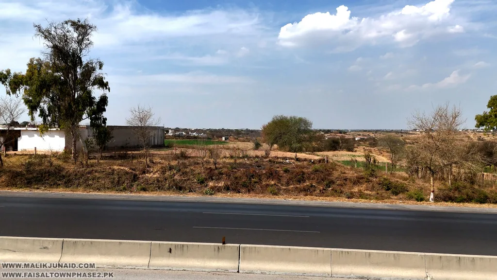
For buyers, that broader location story matters just as much as the internal map. A good society can still be difficult to sell later if the access story is weak. Faisal Town Phase 2’s linked pages keep emphasizing location and connectivity because those are core parts of its value proposition. That is also why map-based content and development-update content are closely tied across the official site. You can browse the latest development updates and video updates after checking the map to get a better sense of the project on the ground.
Faisal Town Phase 2 Google map vs official master plan
This is where many buyers get confused.
The official master plan or high-resolution map is best for:
- sector layout,
- block names,
- plot-size grouping,
- main road understanding,
- and overall planning logic.
Google Maps is best for:
- route navigation,
- travel time,
- satellite surroundings,
- approach roads,
- and on-ground orientation.
The official map page directly says the high-resolution layout helps users review block distribution, plot sizes, road networks, and key development areas, and it offers PDF and JPG download options. The MalikJunaid Google Maps guide says buyers can combine that emap with Google Maps to navigate sectors, view surroundings, and get turn-by-turn directions to the site. So the smartest method is not choosing one over the other. It is using both together.
If you want downloadable resources first, check the official map page, the map view/download guide, and the master plan download page. These are especially useful when you need to zoom into sectors before discussing options with family or comparing files.
How to use Faisal Town Phase 2 Google map step by step
If you want a practical method, use this process:
1. Open the official map or emap first
The official map page and emap page are built for understanding the project layout. The map page says it is designed to help buyers review individual plot locations accurately, while the emap page says it helps users locate plots by sector and block and view development status.
2. Search the project on Google Maps
The Google Maps guide explains that users can search for Faisal Town Phase 2 on Google Maps to view its location near Thalian Interchange and see nearby roads, highways, and infrastructure. This gives you immediate regional context before you even visit.
3. Compare sectors on the layout
Use the official map to understand where sectors, roads, and key zones sit within the project. The map page lists sector-map downloads for grouped sectors, including Q-R-S-T and Overseas W-X, which shows that the site is trying to make sector-level navigation easier for buyers.
4. Use satellite view for nearby development
Google Maps can help you read the surroundings, access roads, and adjacent areas, while the official videos page helps you cross-check current on-ground work such as road construction, plot leveling, and infrastructure progress.
5. Plan your site visit
Once you understand the map, you can use Google Maps directions for the visit itself. The Google Maps guide notes that Thalian Interchange serves as the main access point for reaching Faisal Town Phase 2 from Islamabad and Rawalpindi.
What the emap adds for buyers
The Faisal Town Phase 2 emap is one of the most useful tools for buyers who do not want to rely only on general map images. The official emap page says it helps users view the entire layout, find location plots by sector, check plot sizes and availability, and track development progress. A second official page about checking plot development also describes the emap as a tool for locating plots, checking plot sizes in different areas, and seeing the development status of the plot and surrounding areas.
That matters because most buyers are not just choosing a society. They are choosing a specific sector and, eventually, a specific plot position. A general location pin on Google Maps cannot answer that question by itself. The emap fills that gap by giving internal project structure. Google Maps then complements it by showing the external context. That combination is especially useful for buyers comparing Sector O, Overseas areas, or newer growth pockets within the scheme.
Faisal Town Phase 2 sectors and map reading
The official map page makes it clear that Faisal Town Phase 2 is now being presented in a sector-driven way. It lists sector pages from A through Y, plus named areas like the Overseas Enclave, Education City, Model Block, and Sports City. That tells buyers two things. First, the master plan is extensive enough that map reading matters. Second, sector choice is becoming one of the biggest parts of the buying process.
For a buyer, map reading should focus on:
- sector placement,
- closeness to major internal roads,
- nearness to likely commercial activity,
- access from the main approach,
- and the overall logic of the block inside the society.
If you want a broader understanding of how sectors are being discussed, the sector-wise guide can help as a companion piece after reviewing the official map.
Development updates and why they matter after checking Google map
The Faisal Town Phase 2 Google map helps with navigation and context, but it does not replace development research. The official videos page says it covers road construction, plot leveling, and infrastructure updates, while the emap page and related guides mention ongoing development, wide roads, utilities, green spaces, and sector-wise activity. That means a buyer should not stop after looking at the map. The next step should always be checking progress content.
This is where many good investors gain an advantage. They do not just ask, “Where is the society?” They ask:
- Which part of the layout is receiving attention?
- Which sectors are easier to understand on the map?
- Which roads and zones appear more promising?
- What do official development updates show after map review?
To follow this properly, use the development updates page, the videos page, and the news section.
Payment plan, booking, and map use together
Buyers often jump from Google Maps directly to price. A better sequence is:
map → sector understanding → development check → payment plan → booking
That process leads to fewer mistakes.
The official payment plan page currently describes residential plans with 16 quarterly installments over 48 months and 18 quarterly installments over 54 months, with listed residential plot sizes including 5.56 Marla, 8 Marla, 10.89 Marla, 14.22 Marla, 1 Kanal, and 2 Kanal. It also describes a separate commercial plan tied to a 350-foot-wide Main Boulevard. These details matter more after you understand the map, because a payment plan only becomes meaningful once you know what kind of location and sector you are paying for.
After map review, buyers can continue with the official payment plans page and the official plots for sale page. The plots page highlights residential and commercial options and specifically mentions 5 Marla, 8 Marla, 10 Marla, 14 Marla, and 1 Kanal availability for buyers looking at live inventory.
Faisal Town Phase 2 Google map for site visit planning
For many buyers, the first real use of the Faisal Town Phase 2 Google map is a site visit. This is where live navigation becomes helpful. The MalikJunaid guide explains that Google Maps directions can be used to reach the project from different parts of Islamabad and Rawalpindi and specifically notes Thalian Interchange as the main access point. It also suggests using Street View and surrounding-area review to understand the approach better before you travel.
A good site-visit approach is:
- review the official map first,
- shortlist the sectors you want to inspect,
- open Google Maps and set your route,
- check nearby landmarks and road approaches,
- then compare what you see on the ground with the official development content.
That makes the visit more productive and helps you ask better questions when discussing booking or resale opportunities.
Important caution about legal verification
The official map page and payment-plan page both include a clear caution: buyers should verify legal approvals and the latest NOC status with the relevant authority, including the Rawalpindi Development Authority, rather than relying only on website content. That is an important reminder for any real estate buyer. A map, emap, or Google Maps location can help you understand placement and access, but it is not a substitute for legal due diligence.
So before booking, always do the following:
- review the map and emap,
- compare sectors,
- check official development updates,
- study payment plans,
- confirm plot details,
- and independently verify current approval status.
That is the safest way to use map-based research in a real buying decision.
Final thoughts on the Faisal Town Phase 2 Google map
The Faisal Town Phase 2 Google map is most useful when you treat it as part of a larger buyer toolkit. Google Maps helps with route planning, site approach, and outside context. The official high-resolution map helps with layout reading, block distribution, sector study, and plot positioning. The emap adds another layer by helping users locate plots, review sectors, and follow development status. When these tools are used together, buyers get a much clearer picture of Faisal Town Phase 2 Islamabad than they would from a simple brochure or social media post.
If you want help understanding the map, choosing a sector, checking plot options, or planning a site visit, start with the official website, the maps hub, the official emap, and the contact page. You can also explore buyer guides on WWW.MALIKJUNAID.COM and call 03355592930 or 03331003535 for direct assistance.
6. FAQs
What is the Faisal Town Phase 2 Google map?
The Faisal Town Phase 2 Google map usually refers to using Google Maps to find the project location, access roads, and travel directions, while the official map and emap are used to understand sectors, layout, plot areas, and internal planning.
Where is Faisal Town Phase 2 on Google Maps?
The linked pages place Faisal Town Phase 2 near Thalian Interchange, with access tied to the M-2 Motorway and the Islamabad airport zone. The Google Maps guide specifically describes it as searchable on Google Maps near Thalian Interchange.
What is the difference between Faisal Town Phase 2 map and emap?
The official high-resolution map focuses on the master plan, block distribution, road network, and sector layout, while the emap is described as a more interactive tool for locating plots, checking sector/block position, viewing plot sizes, and tracking development.
Can I use Faisal Town Phase 2 Google map for a site visit?
Yes. The Google Maps guide explains that buyers can use Google Maps directions to reach the project and identifies Thalian Interchange as the main access point from Islamabad and Rawalpindi.
Where can I download the Faisal Town Phase 2 map?
You can use the official map page, which provides PDF and JPG download options, and you can also check supporting pages like the map download/view guide and master plan guide.
Should I rely only on the Faisal Town Phase 2 Google map before booking?
No. The official pages themselves advise buyers to verify legal approvals and NOC status independently. A smart decision should combine map review, emap use, development updates, payment-plan review, and independent due diligence.