
When buyers search faisal town phase 2 map zameen, they are usually trying to answer one simple question before investing: where exactly is the project, and how can I understand the map properly before booking? That is the right question to ask. In a project as large and sector-based as Faisal Town Phase 2 Islamabad, the map is not just a brochure image. It is a practical buyer tool that helps you understand the layout, sectors, access roads, plot positioning, and how the society connects to the wider Islamabad-Rawalpindi region. The official project website now has a dedicated maps hub, a high-resolution master plan page, and an emap page specifically built to help buyers read the project more clearly.
This is also why the keyword faisal town phase 2 map zameen makes sense from a buyer’s perspective. Many people check property portals and listings first, then try to verify the actual project layout from the official source. Zameen currently shows active Faisal Town Phase 2 listings under Faisal Town – F-18, while the official project pages provide the map, sector references, payment plans, and development pages that help you verify what you are looking at. In short, Zameen may help you see market activity, but the official map and emap are better for understanding the project structure itself.
If you want the best starting points, begin with the official website, then review the maps hub, the official master plan map, and the official emap. For larger map viewing and sector-based reading, you can also use the map download/view guide and the master plan download page.
Why the Faisal Town Phase 2 map matters for buyers
A good project map helps buyers do much more than find a location pin. The official map page explains that the high-resolution Faisal Town Phase 2 map is designed to help users review block distribution, plot sizes, road networks, and key development areas, and it specifically encourages buyers to zoom in and review individual plot locations before making decisions. That makes the map important for both end-users and investors. End-users want to understand livability. Investors want to understand access, positioning, and future resale appeal.
The official emap page adds another layer. It describes the emap as a tool that helps buyers locate plots by sector, block, and plot size, and says it can be used to view the layout, check plot sizes and availability, and track development progress. That means if you are only using a property portal screenshot or a single listing image, you are missing a big part of the research process.
For buyers searching faisal town phase 2 latest update, faisal town phase 2 development update, or faisal town phase 2 best location plots, the map becomes even more valuable because it helps connect what you read in updates to where those sectors and roads actually sit inside the society.
Faisal Town Phase 2 location map and regional access
One of the biggest reasons Faisal Town Phase 2 keeps getting attention in Islamabad real estate is its broader location story. Across the official and supporting pages, the project is consistently associated with the Thalian Interchange, access to the M-2 Motorway, and proximity to the Islamabad International Airport. A supporting project overview on MalikJunaid.com also describes Faisal Town Phase 2 as being near Thalian Interchange and Rawalpindi Ring Road and only 2 km from the airport area, reinforcing why location remains one of the project’s strongest selling points.
This is where the faisal town phase 2 location map becomes useful. It helps you understand not only the inside of the society, but also how the project sits relative to surrounding road corridors and nearby developments. Buyers searching faisal town phase 2 thalian interchange, faisal town phase 2 motorway, or faisal town phase 2 rawalpindi are usually trying to confirm accessibility and future movement potential. That logic is exactly why location and map-related content are so closely tied on the official website.
To understand the macro view, start with the official map page and then compare it with the map download/view page. That combination gives buyers both the official layout and a large-format visual for closer review.
Faisal Town Phase 2 map zameen vs official map
If you are typing faisal town phase 2 map zameen, you are probably comparing two types of resources:
- portal-based market listings, and
- official project layout tools.
Zameen currently shows Faisal Town Phase 2 listings and related property inventory under the Faisal Town – F-18 area, which is useful if you want to see market activity, file/plot offerings, and asking-price behavior. But those listing pages are not the same as the project’s own master plan resources. The official map page provides map files, grouped sector maps, and project-wide layout reading tools, while the emap page explains how to locate plots more precisely.
So the smarter approach is not “Zameen or official map.” It is:
- Use portal listings to see what buyers and sellers are talking about.
- Use the official map and emap to verify layout and sector placement.
- Use development pages and videos to understand actual progress.
- Only then compare booking, price, and payment options.
That method reduces confusion and helps you avoid choosing a plot only because it sounds attractive in a listing title.
How to read the Faisal Town Phase 2 map properly
Most buyers open a map and only notice sector names. A better way is to read it in steps.
1. Start with the full master plan
The official map page offers a high-resolution layout and downloadable PDF/JPG options. It also lists grouped sector maps, including sectors like M, N, O & P, Q, R, S & T, and Overseas Sector W & X. That tells you the project is large enough that sector-level understanding matters.
2. Identify main roads and project structure
The official map page says the layout helps buyers review road networks and key development areas. That matters because access roads often influence future demand, convenience, and resale interest. A better-positioned road-facing or better-connected sector can perform differently from a cheaper but weaker-location option.
3. Compare sectors, not just plot numbers
The emap page explains that buyers can use it to locate plots by sector and block and also check sizes and availability. That means a plot decision should begin with sector logic, not end with it. The sector-wise guide can help buyers go beyond a single map image and think in terms of sector character and investment style.
4. Cross-check the map with development updates
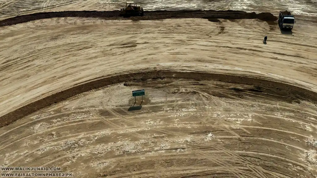
A map shows plan. Development pages show ground activity. The official development page highlights updates around earthwork, sewerage, electricity, road network, plot demarcation, and sector-wise progress, especially around key areas near Thalian Interchange. That is why serious buyers should compare layout understanding with on-ground progress.
Faisal Town Phase 2 Google map, emap, and site-visit planning
Many buyers now want more than a static map. They want to know how to reach the site, how to compare roads and surroundings, and how to shortlist sectors before a visit. A recent MalikJunaid article specifically explains how to use the Faisal Town Phase 2 emap together with Google Maps to locate plots, navigate sectors, and plan a visit. That article says buyers can search for Faisal Town Phase 2 on Google Maps, review surrounding roads and infrastructure, use Google directions, and compare what they see in Google Maps with the official emap. It also highlights Thalian Interchange as the main access point for reaching the project from Islamabad and Rawalpindi.
That makes the following process practical for buyers:
- open the official emap,
- review the sector or block you care about,
- then use Google Maps for live route planning and nearby landmark checks,
- and finally compare that with the official videos page or development updates page.
This is especially helpful if you are planning a faisal town phase 2 islamabad visit and do not want to arrive without understanding where your preferred sector sits.
Map, payment plan, and booking: how they connect
A lot of buyers jump from “map” straight to “price.” A better route is:
map → sector understanding → development check → payment plan → booking
The official payment plan page currently lists residential plans with 16 quarterly installments over 48 months and 18 quarterly installments over 54 months. It also lists available residential plot sizes such as 5.56 Marla, 8 Marla, 10.89 Marla, 14.22 Marla, 1 Kanal, and 2 Kanal, plus a separate commercial plan for plots on a 350 ft wide Main Boulevard. The official plots page separately highlights 5 Marla, 8 Marla, 10 Marla, 14 Marla, and 1 Kanal residential and commercial plots.
These payment and plot details matter more after you understand the map because affordability alone is not enough. A lower-cost plot in a weaker position may not be better than a slightly costlier plot in a more strategically placed sector. That is why buyers should review the official payment plans page and the official plots for sale page only after they are comfortable with the layout.
Development updates and why they matter after checking the map
The official development page makes it clear that Faisal Town Phase 2 is not presented only as a map-based concept. It highlights road infrastructure, plot demarcation, site-visit insights, and sector-wise activity. Supporting project pages also describe ongoing development in terms of road cutting, leveling, and sector planning. For a buyer, this means the map should be read together with development momentum, not separately.
In practice, buyers should ask:
- Which sectors look strong on the map?
- Which sectors are receiving visible development attention?
- Which roads and access points are becoming more important?
- Which sectors fit my time horizon: early investment or near-term use?
That is the type of thinking that turns a map into a real investment tool.
Legal caution buyers should not ignore
The official map page includes an important disclaimer: buyers should verify legal approvals and NOCs through the relevant authorities, including the Rawalpindi Development Authority, and should not treat site content as investment advice. That caution is worth taking seriously. A strong map, good location, and attractive payment plan do not replace legal due diligence.
So before making any final decision, do these checks:
- study the official map and emap,
- review current development content,
- compare payment plans and plots,
- verify file/plot details,
- and independently confirm the latest legal status.
That is the safest way to use faisal town phase 2 map zameen searches as part of real buying research.
Conclusion
If you are searching faisal town phase 2 map zameen, the best strategy is to use that search as a starting point, not the final answer. Portal listings can help you understand what is being offered in the market, but the official Faisal Town Phase 2 map, emap, and development pages are much better for understanding the actual project layout, sectors, road structure, and buyer logic. Together, they give you a clearer picture of Faisal Town Phase 2 Islamabad, especially if you are planning a site visit, comparing sectors, or shortlisting plots for booking.
To explore the project properly, start with the official maps hub, check the official map, review the official emap, and browse buyer guides on WWW.MALIKJUNAID.COM. For direct help with map reading, sector selection, plots, or booking, use the official contact page or call 03355592930 and 03331003535.
6. FAQs
What does “faisal town phase 2 map zameen” usually mean?
It usually means buyers are trying to find the project map while comparing portal listings and the official layout. Zameen shows Faisal Town Phase 2 market listings, while the official website provides the project’s own map, emap, and sector resources.
Where can I see the official Faisal Town Phase 2 map?
You can view it on the official map page and the maps hub, which also supports downloadable map viewing.
What is the difference between the official map and the emap?
The official map is the master-plan style layout for sectors, roads, and blocks, while the emap is presented as a tool for locating plots by sector, block, and size, and for tracking development progress.
Can I use Google Maps for Faisal Town Phase 2?
Yes. A recent guide on MalikJunaid.com explains how buyers can combine the emap with Google Maps for location viewing, route planning, and site visits, with Thalian Interchange described as the main access point.
Does the map help with choosing plots?
Yes. The official map page says it helps buyers review block distribution, plot sizes, road networks, and development areas, while the emap page says it helps locate plots and compare sectors and blocks more precisely.
Should I rely on the map alone before booking?
No. The official site advises independent verification of legal approvals and NOC status, and buyers should also review development updates, plots, payment plans, and current documentation before making a decision.